
Unintentional Hike up Sign Hill
- Patricia
- Jun 6, 2020
- 5 min read
Updated: Jul 3, 2020
Pictures and Text by guest contributor Sarah.
I am not a hiker. At all. But I am a photographer, and that means when I see something I want to photograph, I need to stop and take photos, usually lots of them. So sometimes I hike unintentionally, because something catches my eye, and I start heading to it, and suddenly I’ve been climbing some damn mountain for 30 minutes and it’s taller than I thought. That’s what happened when I decided to go find The Sign.
I’ve lived in the San Francisco Bay Area most of my life, and each time I drive up 101 to go to San Francisco I see SOUTH SAN FRANCISCO THE INDUSTRIAL CITY in giant white letters on the hillside in San Bruno. When the Giants won the World Series, someone painted the S and F orange, and I decided that was a good time to try to get a closer look.
I didn’t plan ahead for this, just had extra time and thought I’d swing by. I took the exit that seemed closest and started driving around SSF, and didn’t get anywhere close to the letters. Finally, I ended up in a school parking lot with a decent view of the hill, and started taking photos. A teacher who was working on the weekend came out to see what I was doing there, and then was kind enough to give me directions to the park.

View from the school parking lot I found the corner of Poplar and Rocca Avenues, and the park entrance. It’s called Sign Hill Park, very practical. I wonder if it’s one of those cases where a committee wanted to name it after someone, like a local historic figure, Portola Hill or Serra Hill, but everyone just called it Sign Hill, so that’s what it became.

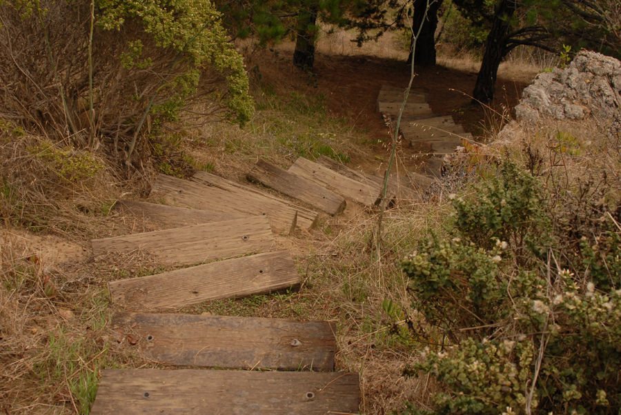
Sign at park entrance I only had my camera bag and me, no special gear, and slip on shoes, but figured this was a quick stop, maybe 15 or 20 minutes to get up to the letters, no problem, right? I started up the path, which was dirt with lots of rocks, winding around a bit as it started up the side of the hill. There were railroad ties set into the path in some sections and a lot of erosion around them, so each was a deeper step than expected, plus the ties were often crooked and the ground around them was uneven. Goody.

Path with railroad ties The path varied from a moderate to a fairly steep angle and went through a variety of trees (mostly pine), bushes, and wildflowers. As I got higher up, I could see glimpses of the residential neighborhoods through the trees and then started to see father out to the bay waters and the airport.

View of the SSF neighborhood

View of the airport and the bay After about 20 minutes, I was tired of my feet slipping out of my shoes, and my leg muscles were sore from the high stepping required to get over the railroad ties, but I’d already put in this much effort, and I figured I must almost be at the top, so kept going. It took about 40 minutes to get to the letters and by then I was over the climb and my asthma was kicking in a bit. But the letters... wow, I’d never seen anything like this before. OK, worth it.

At the bottom of the letters
I figured that the letters that were transported up the hill and set in place, but these were made out of asphalt, paved in place, and painted. So somehow, someone got paving equipment up this hill and made these. Bet that was a challenge.

Side view of letters

At the top of the letters I took a bunch of photos, and walked over to the back side of the hill the take photos of the pretty row of condos.

View of the suburbs and bay

Rows of condos at the base of San Bruno mountain

Plane taking off at SFO I got some nice views of the airport and watched planes landing. Then I noticed that it was getting more overcast, and was that... rain? Yes, crap. One of my special talents is for picking the worst option, like the slowest line in the grocery store, so when I saw a different path for the Ridge trail, I knew it must be a much worse path, and decided to stick to the one I came up on.

Don’t fall for the pretty sign But going down it somehow seemed much steeper, almost entirely railroad ties, and I realized I was on a different path anyway, and yes, a worse one. Yay me.
Hell no. Off the path, the ground was all pine needles, so very slippery, so I needed to stick to the path and tough it out. In the rain. I didn’t bring a hat or jacket, and I don’t even own rain gear, and those damn railroad ties are HARD to navigate and impossible to go quickly on, so it was big step down, wipe the rain off my glasses, big step down, look to see if I’m there yet, wipe, big step down. For over 30 minutes. Or maybe it was 10, but it felt like forever. Major Stairmaster work. I was mostly successful at not sliding out of my shoes but lost one a couple times.

Looking back up while going down the overly steep trail I made it back to the car wet but not soaked through, with shaky legs, and a fresh appreciation for how much I don’t like hiking. But totally worth it.

Slipperier and steeper than it looks
In summary I’d say this was a pretty steep route up and back, round trip about 90 minutes with 15 minutes of just taking photos. Yes, I’d do it again. But with better shoes. It was Sunday afternoon, but I only saw one other person the entire hike, so either this is a little known route, or everyone else is better at checking the weather first.
Trivia I looked up the history of the sign on Wikipedia (https://en.wikipedia.org/wiki/South_San_Francisco_hillside_sign) and found out some trivia, for those of you who like these things. It was created in the 1920s and was listed on the National Register of Historic Places in 1996. The letters are set on the south side of a steep 581-foot hill, part of the San Bruno Mountains, overlooking the city. In order to create the appearance of straight, uniformly sized type despite the varied contour of the hillside, the letters are laid out using anamorphosis, ranging in height from 48 to 65 feet. In 1923, an early version of the sign was carved directly into the hillside and filled with whitewash, consisting of a mixture of lime, white cement, and water. Local high school students were hired to maintain the sign by removing grass and applying fresh whitewash. The current, permanent sign was created in 1929. The S and F have been painted orange each time the Giants win the series, so three times that I’ve seen, and that lasts for a few weeks and then the city paints them white again.

Comments